
NavPad: EFB für die LuftrettungNavPad: EFB for air rescue
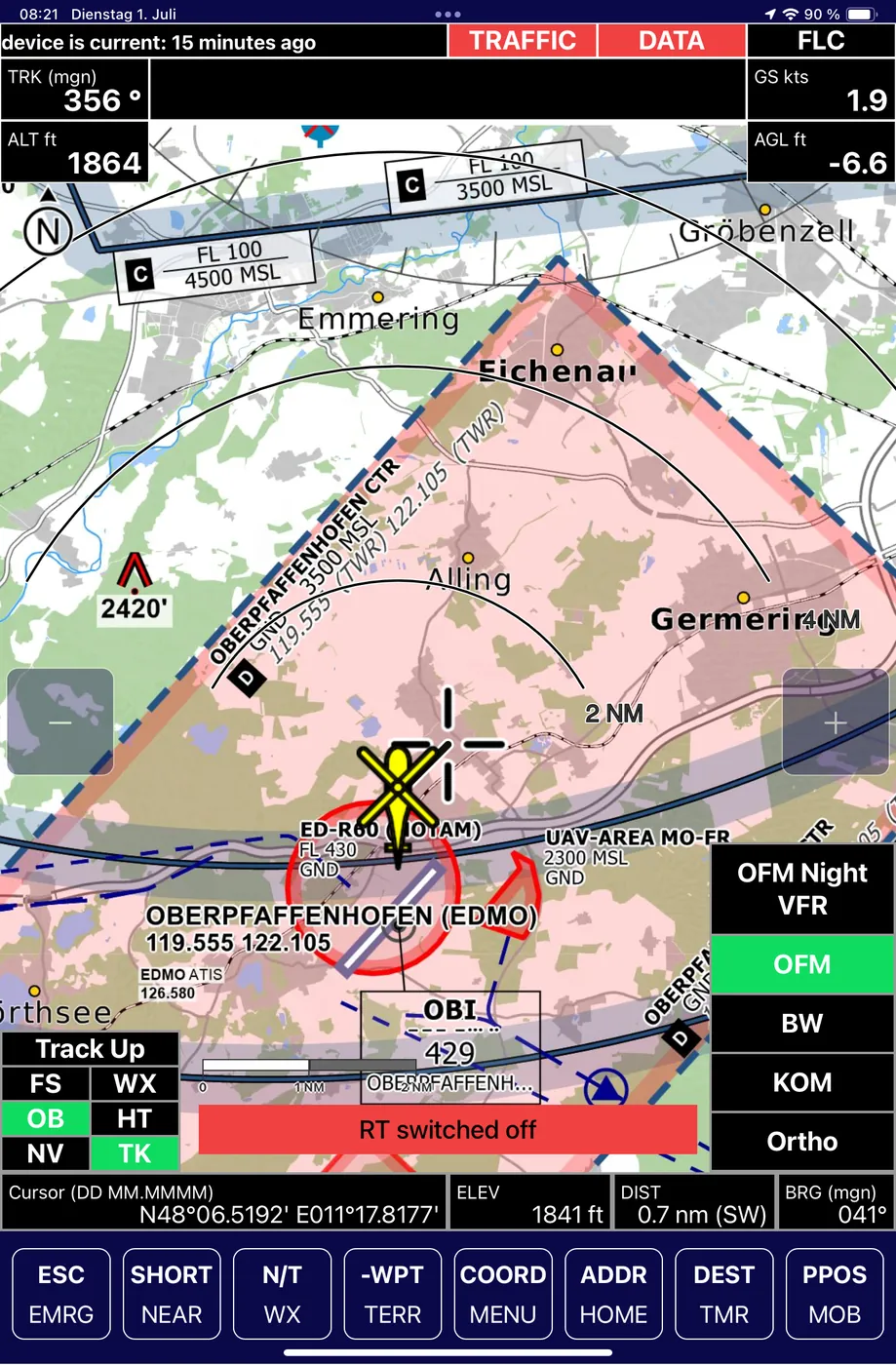
NavPad ist die missionszugelassene EFB-App der Neway-Gruppe für die Luftrettung. Eine Moving-Map auf dem iPad, zugeschnitten auf den HEMS-Einsatz: Nacht-VFR-Karten, Hindernis- und Windpark-Datenbank, integriertes Wetter sowie Krankenhaus- und Tankstellenverzeichnis. Start in unter 20 Sekunden, vollständig offline nutzbar. Im täglichen Betrieb bei der ADAC Luftrettung. NavPad is the Neway Group's mission-approved EFB app for air rescue. A moving map on the iPad, built for HEMS operations: night-VFR charts, obstacle and wind-farm database, integrated weather, and a hospital and fuel-station directory. Boots in under 20 seconds, fully usable offline. In daily service with ADAC Luftrettung.
- KundeCustomer
- ADAC Luftrettung
- PlattformPlatform
- Apple iPad, iOS
- ZulassungCertification
- EFB Type B, seit über 5 Jahren missionszugelassenEFB Type B, mission-approved for over 5 years
- KartenlayerMap layers
- ICAO, Open Flight Maps, Nacht-VFR, Straße, Wandern, SatellitICAO, Open Flight Maps, night-VFR, road, hiking, satellite
- BetriebOperation
- vollständig offline, Over-the-Air-Updatesfully offline, over-the-air updates
- StartBoot time
- unter 20 Sekundenunder 20 seconds
AusgangslageStarting point
Rettungscrews brauchen im Cockpit keine allgemeine Flugnavigation, sondern eine Karte, die den Einsatz kennt: Krankenhaus- und Tankstellenverzeichnis, verlässliche Hindernisdaten für Leitungen, Masten und Windparks, Nacht-VFR-Karten und Werkzeuge für die Suche am Zielort. Etablierte EFB-Systeme starten langsam, lassen sich nur am Boden oder über USB aktualisieren und bieten unflexible Kartenlayer. Rescue crews don't need general flight navigation in the cockpit, but a map that knows the mission: a hospital and fuel-station directory, reliable obstacle data for power lines, masts and wind farms, night-VFR charts, and tools for the search at the destination. Established EFB systems boot slowly, can only be updated on the ground or via USB, and offer inflexible map layers.
AufgabeTask
Eine EFB-App für das iPad, die zulassungsfähig ist, in Sekunden startet, HEMS-spezifische Daten mitbringt, im Flug ohne Netz auskommt und aktuell bleibt, ohne das Luftfahrzeug dafür stillzulegen. An EFB app for the iPad that is certifiable, boots in seconds, brings HEMS-specific data, works without a network connection in flight, and stays current without grounding the aircraft to do so.
LösungSolution
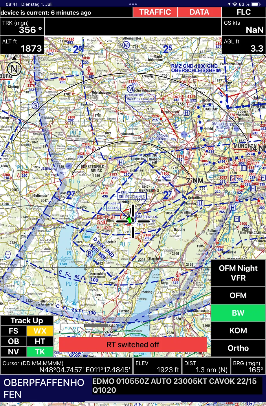
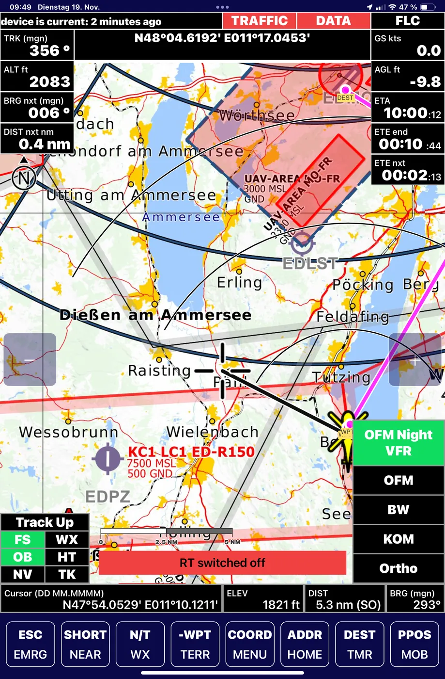
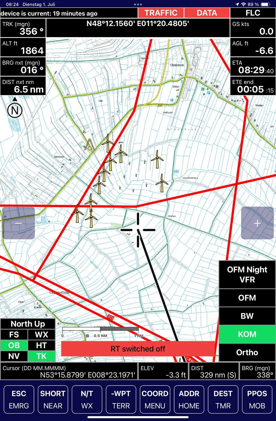
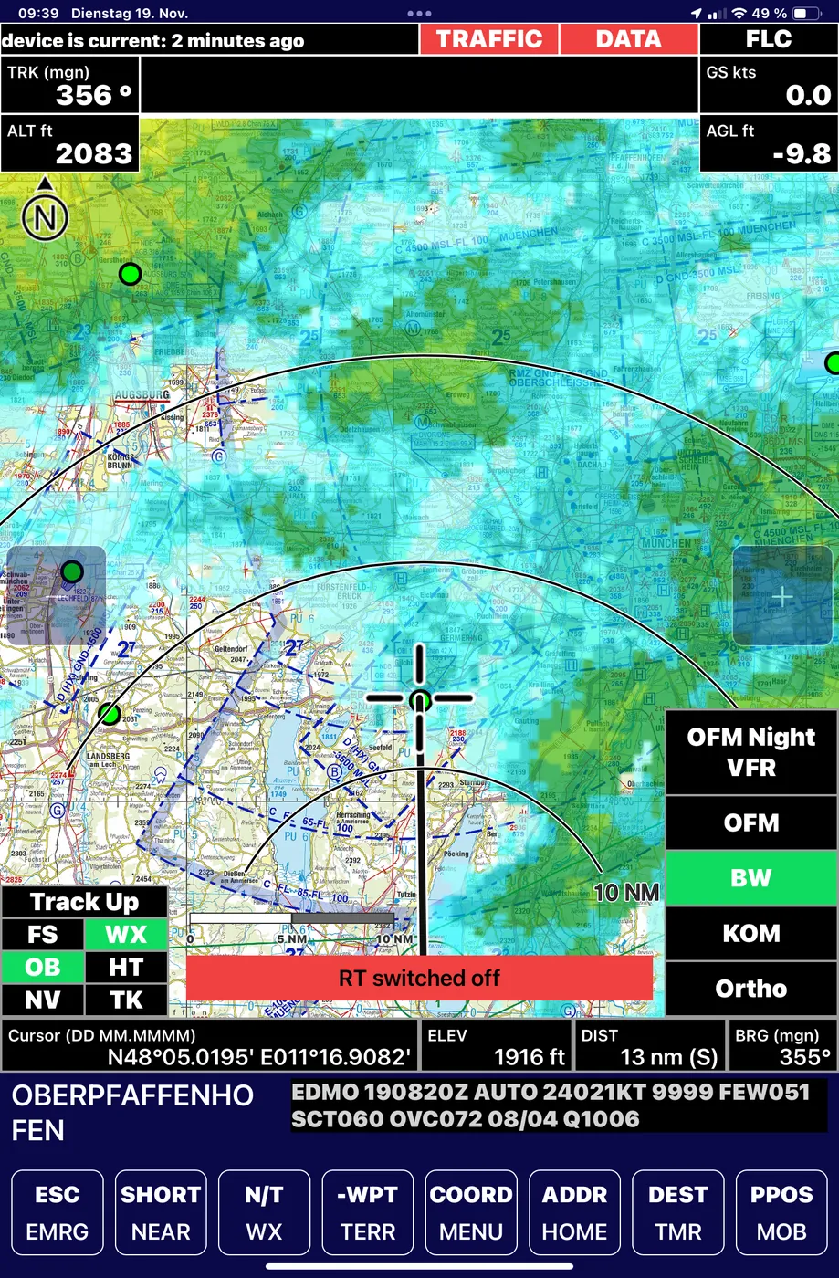
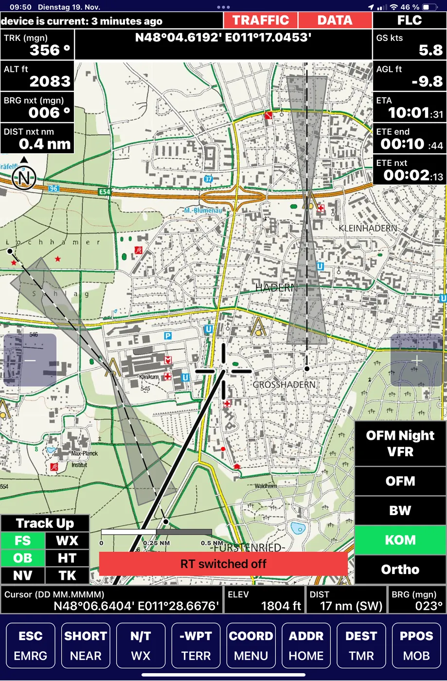
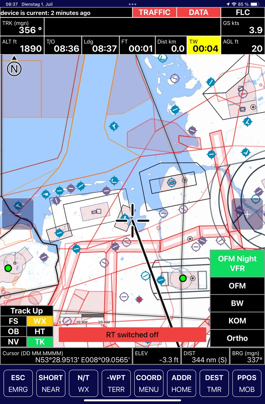
Eine Moving-Map für iOS mit gestapelter Kartografie: amtliche ICAO-Karten, Open Flight Maps inklusive einer eigenen Nacht-VFR- und EMS-Variante, dazu Straßen-, Wander- und Satellitenlayer. Luftraum, Gelände- und Höhendaten sowie eine Hindernisdatenbank für Leitungen, Masten und Windparks mit dynamischer Aktualisierung. A moving map for iOS with layered cartography: official ICAO charts, Open Flight Maps including a proprietary night-VFR and EMS variant, plus road, hiking and satellite layers. Airspace, terrain and elevation data, and an obstacle database for power lines, masts and wind farms with dynamic updates.
Integriert sind Wetter (METAR und Radar), ein Flugplatzverzeichnis mit Tankstellen- und Krankenhausdaten sowie die ADAC-Autobahndatenbank. Timer- und SAR-Funktionen sowie eine intelligente Suche unterstützen die Arbeit am Zielort. Die Datenbank liegt lokal auf dem Gerät, der Start dauert unter 20 Sekunden, Updates kommen over the air. Integrated weather (METAR and radar), an aerodrome directory with fuel-station and hospital data, and the ADAC motorway database. Timer and SAR functions plus intelligent search support work at the destination. The database sits locally on the device, boot time is under 20 seconds, and updates come over the air.
ErgebnisResult
NavPad ist im täglichen Flottenbetrieb der ADAC Luftrettung, als EFB Type B seit über fünf Jahren missionszugelassen. Bedient wird direkt am iPad. Als Erweiterung wird derzeit ein haptisches Bedien- und Kühlmodul für das iPad mini erprobt, das die Kernfunktionen blind bedienbar macht und das Tablet im Temperaturfenster hält. NavPad is in daily fleet service with ADAC Luftrettung, mission-approved as EFB Type B for over five years. It's operated directly on the iPad. As an extension, a haptic control and cooling module for the iPad mini is currently undergoing trials, allowing blind operation of the core functions and keeping the tablet within its temperature window.
Zur Case Study: iPad mini Control BoxRead the case study: iPad mini Control Box
- PlattformPlatform
- Apple iPad, iOS
- StartBoot time
- unter 20 Sekundenunder 20 seconds
- KartenlayerMap layers
- ICAO, Open Flight Maps, Nacht-VFR, Straße, Wandern, SatellitICAO, Open Flight Maps, night-VFR, road, hiking, satellite
- HindernisdatenObstacle data
- Leitungen, Masten, Windparks, dynamischPower lines, masts, wind farms, dynamic
- HEMS-DatenHEMS data
- Krankenhäuser, Tankstellen, ADAC-AutobahndatenbankHospitals, fuel stations, ADAC motorway database
- WetterWeather
- METAR, NiederschlagsradarMETAR, precipitation radar
- WerkzeugeTools
- Timer, SAR, intelligente SucheTimer, SAR, intelligent search
- BetriebOperation
- offline, Over-the-Air-Updatesoffline, over-the-air updates
WeiterentwicklungNext evolution
Für den nächsten Schritt entsteht gemeinsam mit der ADAC Luftrettung NavPad OG: die bewährte NavPad-Software als eigenständiger Missionsrechner nativ auf dem Airbus-Helionix-Cockpitdisplay, ohne separates Tablet. Cockpit-Bilder und der technische Vergleich stehen auf der eigenen Seite. For the next step, Neway is developing NavPad OG together with ADAC Luftrettung: the proven NavPad software as a standalone mission computer, native on the Airbus Helionix cockpit display, without a separate tablet. Cockpit images and the technical comparison are on its own page.
Zur Weiterentwicklung: NavPad OGRead about the evolution: NavPad OG
Missionssoftware oder EFB-Lösung für Ihren Betrieb?Need mission software or an EFB solution for your operation?
Projekt anfragenStart a project